


Dedham Precinct 3, Norfolk County, Massachusetts
About
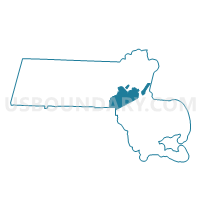
Outline

Summary
| Unique Area Identifier | 594878 |
| Name | Dedham Precinct 3 |
| County | Norfolk County |
| State | Massachusetts |
| Area (square miles) | 0.65 |
| Land Area (square miles) | 0.63 |
| Water Area (square miles) | 0.03 |
| % of Land Area | 95.99 |
| % of Water Area | 4.01 |
| Latitude of the Internal Point | 42.24876120 |
| Longtitude of the Internal Point | -71.15111520 |
Maps


Graphs
Select a template below for downloading or customizing gragh for Dedham Precinct 3, Norfolk County, Massachusetts


Neighbors
Neighoring Voting District (by Name) Neighboring Voting District on the Map
- Boston Ward 18 Precinct 19, Suffolk County, MA
- Boston Ward 18 Precinct 20, Suffolk County, MA
- Boston Ward 18 Precinct 23, Suffolk County, MA
- Boston Ward 20 Precinct 15, Suffolk County, MA
- Boston Ward 20 Precinct 3, Suffolk County, MA
- Dedham Precinct 4, Norfolk County, MA
- Dedham Precinct 5, Norfolk County, MA
- Dedham Precinct 6, Norfolk County, MA
Top 10 Neighboring County Subdivision (by Population) Neighboring County Subdivision on the Map
Top 10 Neighboring Place (by Population) Neighboring Place on the Map
Top 10 Neighboring Unified School District (by Population) Neighboring Unified School District on the Map
Top 10 Neighboring State Legislative District Lower Chamber (by Population) Neighboring State Legislative District Lower Chamber on the Map
- Eleventh Norfolk District, MA (42,255)
- Tenth Suffolk District, MA (42,147)
- Fourteenth Suffolk District, MA (38,888)
Top 10 Neighboring State Legislative District Upper Chamber (by Population) Neighboring State Legislative District Upper Chamber on the Map
Top 10 Neighboring 111th Congressional District (by Population) Neighboring 111th Congressional District on the Map
Top 10 Neighboring Census Tract (by Population) Neighboring Census Tract on the Map
- Census Tract 4024, Norfolk County, MA (6,050)
- Census Tract 1304.06, Suffolk County, MA (5,107)
- Census Tract 1401.02, Suffolk County, MA (4,401)
- Census Tract 4021.02, Norfolk County, MA (4,063)
- Census Tract 4022, Norfolk County, MA (2,169)